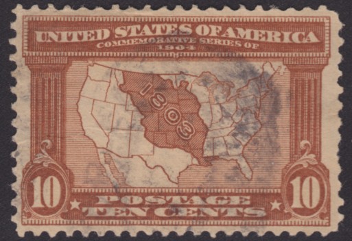
10¢ Map of Louisiana Purchase
Date of issue: April 30, 1904
Over the years, the United States has issued several stamps commemorating the Louisiana Purchase, but it is the 10¢ Louisiana Purchase Exposition stamp that illustrates better than any other the extent of the territory acquired. The purchase almost doubled the size of the young country, which is illustrated by the shaded portion of the U.S. map featured on the stamp.1
The stamp, which was printed in brown, filled many needs, but it most conveniently paid first-class postage plus registration fee and the double weight international rate.2

References
- Exhibit: The Louisiana Purchase. National Archives and Records Administration. Mar. 1996. Accessed 14 July 2011.
- Haimann, Alexander T. 10-cent Map of Louisiana Purchase. Arago: People, Postage & the Post. 26 Jan. 2007. Accessed 14 July 2011.
Published 2018-06-21